Image:706px-Map-Germany-1945.svg013.png
From Textus Receptus
No higher resolution available.
706px-Map-Germany-1945.svg013.png (706 × 600 pixel, file size: 113 KB, MIME type: image/png)
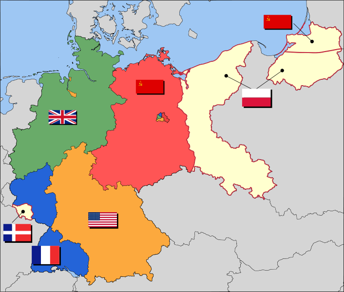
Occupation zones of Germany, 1947, with territories east of the Oder-Neisse line under Polish administration or Soviet annexation, plus the Saar protectorate and divided Berlin. East Germany was formed by the Soviet Zone, while West Germany was formed by the American, British and French zones in 1949 and the Saar in 1957.
File history
Click on a date/time to view the file as it appeared at that time.
| Date/Time | Dimensions | User | Comment | |
|---|---|---|---|---|
| current | 07:04, 28 January 2010 | 706×600 (113 KB) | Xangenz (Talk | contribs) | (Occupation zones of Germany, 1947, with territories east of the Oder-Neisse line under Polish administration or Soviet annexation, plus the Saar protectorate and divided Berlin. East Germany was formed by the Soviet Zone, while West Germany was formed by ) |
- Search for duplicate files
- Edit this file using an external application
See the setup instructions for more information.
Links
The following page links to this file:
